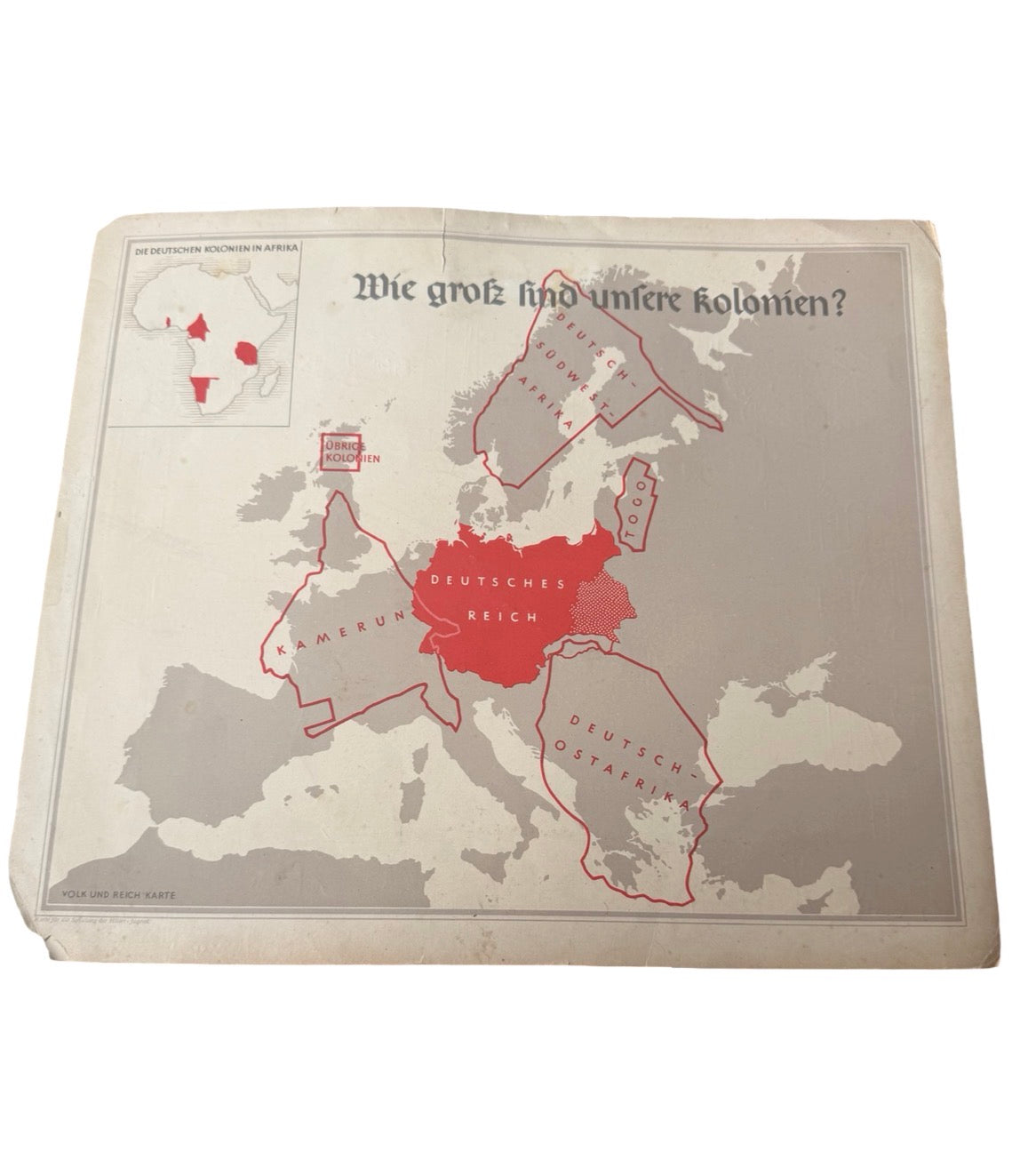
Original period German colonial propaganda training map titled “Wie groß sind unsere Kolonien?” (“How large are our colonies?”), produced for Hitler Youth instructional use during the Third Reich era. Not very many like these are left in circulation.
This educational wall chart visually compares Germany’s former African colonies against Europe and was intended for political/youth training purposes in pre-war Germany. The lower corner is marked: “Karte für die Schulung der Hitler-Jugend” (“Map for the instruction/training of the Hitler Youth”).
Features:
Original period printed map
Colonial propaganda / educational piece
“Volk und Reich Karte” series
German colonial territories shown:
Deutsch Südwest Afrika
Deutsch Ostafrika
Kamerun
Togo
Strong display appeal
Rare historical paper item
Condition: Shows age-related wear including creasing, edge wear, staining, and corner damage as shown in photos. Overall still displays very well considering age. Other wise brilliant condition for the age
A scarce and historically significant Third Reich educational propaganda item ideal for collectors of WW2 militaria, propaganda material, Hitler Youth items, or historical maps.